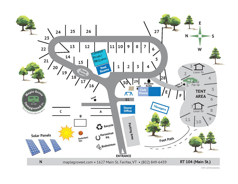
Campground Map
Campground Map displays where each site is located. It is an aerial view, so we will be using language to describe it as a flat, 2D image. The main entrance leads you to the camping site. To the left of the main entrance, you will find a Badminton Net, Horseshoe Pit, and Recycling Center. To the right of the main entrance, you will find a parking area and the store/office. You will then reach a fork in the road. Turn right to find a playground to one side and the first campsites. Continuing on this path, you will make one loop to return to the original fork in the road.
All 26 campsites are found on this loop. The covered picnic area, laundry services, and restrooms are located at the center of this loop. Other items on the map include a basketball net, the tent and rental area, solar panels, and the propane refill station.
Please call the office for further instructions if you wish to select a specific campsite, but are unable to use the map to do so. If for any reason you are unable to consult this map, please call (802) 849-6439 for further accommodations or assistance.

